How Vehicles and Drones Find Their Way Using Many Sensors
This patent describes a layered computer system that combines data from many different sensors and an Inertial Measurement Unit to precisely determine a mobile platform's position, velocity, and orientation, even in challenging environments.
Original patent title: “Adaptive navigation for airborne, ground and dismount applications (ANAGDA)”
This patent describes a layered computer system that combines data from many different sensors and an Inertial Measurement Unit to precisely determine a mobile platform's position, velocity, and orientation, even in challenging environments. Granted to Northrop Grumman Systems in 2018 with 23 claims and 5 forward citations, and it is expected to expire in 2037.
Coverage
What does this patent actually cover?
This patent describes an adaptive navigation system for mobile platforms like aircraft, ground vehicles, or even dismounted soldiers. It uses a computer onboard the platform with a specific layered architecture to combine various data sources. First, a sensing layer gathers signals from multiple sensors, such as cameras, GPS, or lidar (ClaimclaimA numbered sentence at the end of a patent that legally defines what the inventor owns. The most important section.Read more → 5). Next, a processing layer prepares this raw sensor data, potentially using pre-loaded maps or landmark databases (Claim 6). A measurement abstraction layer then converts this data into a standard format, making it independent of the specific sensor hardware. Finally, a fusion layer combines this processed sensor data with movement information from an Inertial Measurement Unit (IMU) to calculate the platform's exact position, velocity, and attitude (Claim 1). For example, an unmanned aerial vehicle (UAV) preparing to land on a moving ship could use this system to fuse its camera images of the ship, GPS data, and its own IMU readings to precisely calculate its relative position to the ship, ensuring a safe landing (Claim 11).
The gap
What does this patent NOT cover?
- Does not cover navigation systems that do not include an Inertial Measurement Unit (IMU) onboard the mobile platform.
- Does not cover systems that lack the specific layered architecture of sensing, processing, measurement abstraction, and fusion layers as described in the claimsclaimsThe numbered statements at the end of a patent that legally define what the inventor owns.Read more →.
- Does not cover navigation systems that rely solely on a single type of sensor without fusing it with IMU data and other sensor measurements.
- Does not cover systems where the fusion calculations do not also produce error estimates, such as IMU error or sensor alignment error (ClaimclaimA numbered sentence at the end of a patent that legally defines what the inventor owns. The most important section.Read more → 2).
- Does not cover navigation systems that do not produce a full 'platform navigation state' including position, velocity, and attitude.
These exclusions are unique to PatentBrief — derived from the actual claim language, not patent-office boilerplate.
Key facts
What made this novel
The noveltynoveltyThe requirement that an invention be different from anything publicly known before its priority date.Read more → lies in its adaptive, hierarchical architecture that intelligently fuses diverse sensor data with IMU information, and critically, incorporates geo-registration to continuously correct for accumulating errors over time, ensuring sustained accuracy.
The Patent Drawing
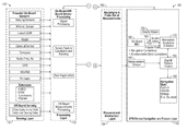
Schematic visualization of the patent's claim structure. Hand-drawn diagrams in progress for each landmark patent.
Where you've seen this
Real-world examples
Autonomous military drones
Precision-guided munitions
Advanced aircraft navigation systems
Robotic ground vehicles for reconnaissance
Unmanned underwater vehicles (UUVs)
Why it matters
The bigger picture
This technology is crucial for autonomous systems that need to operate reliably in environments where traditional GPS signals might be unavailable, jammed, or spoofed. By fusing diverse sensor inputs with IMU data, it provides a robust and accurate positioning, navigation, and timing (PNT) solution. This capability is vital for military applications, such as guiding airborne weapons or operating unmanned aerial vehicles, where precision and resilience against signal interference are paramount.
Filed
March 8, 2017
Granted
October 23, 2018
Market context
Who's building on this
Companies in this space
Northrop Grumman, the assigneeassigneeThe entity that owns the patent — usually the inventor's employer or a company.Read more →, continues to be a major player in advanced navigation systems for defense and aerospace. Other large defense contractors like Lockheed Martin and Raytheon, as well as companies developing autonomous vehicles and robotics, are actively working on similar multi-sensor fusion technologies to enhance navigation accuracy and robustness.
Market impact
This patent contributes to the ongoing development of highly resilient navigation systems, particularly important for military and high-stakes industrial applications. It enables more reliable autonomous operations in GPS-denied or degraded environments, which has driven advancements in precision guidance for defense systems and expanded the capabilities of unmanned platforms. The structured approach to sensor fusion outlined in the patent helps set a standard for robust PNT solutions.
Claim 1 — Plain English
What this patent covers
This patent describes an adaptive navigation system for mobile platforms like aircraft, ground vehicles, or even dismounted soldiers. It uses a computer onboard the platform with a specific layered architecture to combine various data sources. First, a sensing layer gathers signals from multiple sensors, such as cameras, GPS, or lidar (Claim 5). Next, a processing layer prepares this raw sensor data, potentially using pre-loaded maps or landmark databases (Claim 6). A measurement abstraction layer then converts this data into a standard format, making it independent of the specific sensor hardware. Finally, a fusion layer combines this processed sensor data with movement information from an Inertial Measurement Unit (IMU) to calculate the platform's exact position, velocity, and attitude (Claim 1). For example, an unmanned aerial vehicle (UAV) preparing to land on a moving ship could use this system to fuse its camera images of the ship, GPS data, and its own IMU readings to precisely calculate its relative position to the ship, ensuring a safe landing (Claim 11).
The clever bit
The novelty lies in its adaptive, hierarchical architecture that intelligently fuses diverse sensor data with IMU information, and critically, incorporates geo-registration to continuously correct for accumulating errors over time, ensuring sustained accuracy.
What it does not cover
- Does not cover navigation systems that do not include an Inertial Measurement Unit (IMU) onboard the mobile platform.
- Does not cover systems that lack the specific layered architecture of sensing, processing, measurement abstraction, and fusion layers as described in the claims.
- Does not cover navigation systems that rely solely on a single type of sensor without fusing it with IMU data and other sensor measurements.
- Does not cover systems where the fusion calculations do not also produce error estimates, such as IMU error or sensor alignment error (Claim 2).
- Does not cover navigation systems that do not produce a full 'platform navigation state' including position, velocity, and attitude.
Patent timeline
Application submitted to the patent office
Application published, typically 18 months after filing
Patent officially issued
Patent enters public domain
PatentBrief Score
Impact Score
Moderate
Citation count
16/40
Early citations
Claim breadth
15/20
Broad claimsclaimsThe numbered statements at the end of a patent that legally define what the inventor owns.Read more →
Recency
10/20
Granted 5–10 years ago
Assignee scale
0/20
Independent or smaller assigneeassigneeThe entity that owns the patent — usually the inventor's employer or a company.Read more →
PatentBrief Impact Score — based on citation count, claim breadth, recency, and assignee scale. Not a legal assessment.
Heuristic Value Estimate
What this patent might be worth
$49K – $156K
Midpoint $98K · 10.4 yr remaining · industry ×1.5
Heuristic only — blends forward/backward citation counts, claim scope, time remaining, litigation history, and CPC-derived industry baseline. Real valuations need a professional appraisal.
Claim text not yet imported for this patent
The original legal language
Original claims
23 claims as filed with the patent office.
Concepts involved
Citations
Patent lineage
Cite this patent
Fung, A. C., Thai, B. M., & Aboutalib, O. (2018). How Vehicles and Drones Find Their Way Using Many Sensors (U.S. Patent No. 10,107,627). U.S. Patent and Trademark Office. https://patentbrief.org/patent/us/10107627/adaptive-navigation-for-airborne-ground-and-dismount-applications-anagda
Auto-generated from the patent record. Double-check author order and the issue date against the official USPTO document before submitting.
Embed
Add this patent to your site
Drop this plain-English patent card into any blog post or article — free, no signup. It always links back to the full breakdown here.
<div data-patentlens-widget data-patent-number="US10107627"></div>
<script src="https://patentbrief.org/embed.js" async></script>
Stay in the loop
Get a weekly digest of new patents.
One email per week. No spam. Unsubscribe anytime.
Keep exploring
Related patents you should know
US 4683195 · 1987
How to Make Billions of Copies of a DNA Segment
This patent describes the Polymerase Chain Reaction (PCR), a method to rapidly create many copies of a specific piece of DNA or RNA, enabling its detection and analysis.
Cetus Corp
US 8697359 · 2014
How to Edit Genes in Human Cells Using an Engineered CRISPR System
This patent describes an engineered CRISPR-Cas9 system for precisely cutting DNA in eukaryotic cells to change how genes work, opening the door for gene editing in complex organisms.
Massachusetts Institute of Technology
US 7657849 · 2010
How the iPhone's Slide-to-Unlock Gesture Works
Apple's 2010 patent describes unlocking a device by dragging a specific graphical image across the touchscreen along a predefined path, a gesture that became iconic with the original iPhone.
Apple Inc
US 4733665 · 1988
How Doctors Implant a Permanent Stent Using a Balloon
This patent describes the method for placing a permanent, expandable wire mesh tube inside a blood vessel or other body tube using a balloon-tipped catheter to widen it and keep it open.
Expandable Grafts Partnership
US 4965188 · 1990
How to Make Many Copies of a DNA Piece with Heat
This patent describes the Polymerase Chain Reaction (PCR) method, a technique to make millions of copies of a specific DNA segment using a heat-resistant enzyme and repeated temperature changes.
Cetus Corp
US 4235871 · 1980
How to Encapsulate Active Materials in Lipid Bubbles Efficiently
This patent describes a method for trapping biologically active substances inside tiny, multi-layered fat bubbles called liposomes, using a specific water-in-oil emulsion and gel-forming process to improve how much material gets captured.
Individual
Semantically similar
You might also find these interesting
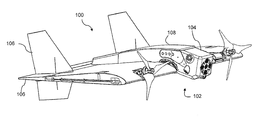
US 9562773 · 2017 · Aurora Flight Sciences
Drone Navigation Using Cameras and Echolocation
US 12737436 · 2026
Efficiently Combining Data from Different Sensors
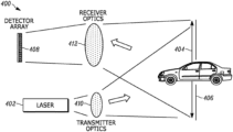
US 20240045038 · Opsys Tech
How a Smart LIDAR System Adapts to Noise for Better Distance Sensing
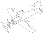
US 9518821 · 2016
Using a Smartphone to Autonomously Control a Vehicle's Direction
More to explore
More in Software & Internet
US 4405829 · 1983 · Massachusetts Institute of Technology
How RSA Public-Key Encryption Keeps Digital Messages Secret
US 6285999 · 2001 · Leland Stanford Junior University
How Websites Get Ranked by Importance
US 5960411 · 1999 · Amazon com Inc
How Amazon's One-Click Ordering Works for Online Purchases
US 7669123 · 2010 · Facebook Inc
Displaying Friends' Activities in a Social Network Feed
New to patents?
Common Questions
Frequently Asked Questions
What does How Vehicles and Drones Find Their Way Using Many Sensors cover?
This patent describes a layered computer system that combines data from many different sensors and an Inertial Measurement Unit to precisely determine a mobile platform's position, velocity, and orientation, even in challenging environments.
Who owns patent US 10107627?
Northrop Grumman Systems owns this patent, granted in 2018.
When does this patent expire?
This patent is expected to expire on March 8, 2037, when the invention enters the public domain.
What is patent US 10107627 cited by?
This patent has been cited by 5 later patents that build on its ideas.
What problem does this patent solve?
This technology is crucial for autonomous systems that need to operate reliably in environments where traditional GPS signals might be unavailable, jammed, or spoofed. By fusing diverse sensor inputs with IMU data, it provides a robust and accurate positioning, navigation, and timing (PNT) solution. This capability is vital for military applications, such as guiding airborne weapons or operating unmanned aerial vehicles, where precision and resilience against signal interference are paramount.
What does this patent NOT cover?
Does not cover navigation systems that do not include an Inertial Measurement Unit (IMU) onboard the mobile platform.
Patent monitoring